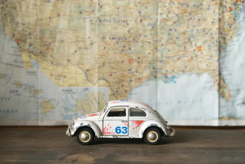
The Folded Paper Oracle That Every American Driver Worshipped
The Ritual of Route Planning
Every Sunday night in American households, a familiar scene played out across kitchen tables from Maine to California. Dad would spread out the enormous Rand McNally atlas, Mom would trace possible routes with her finger, and the kids would argue over whether the scenic route through the mountains was worth the extra two hours. This wasn't just trip planning — it was a family ceremony that required actual skill, patience, and a healthy dose of optimism.
The road atlas wasn't just a book; it was a survival manual. You studied it like scripture, memorizing exit numbers and highway intersections. Interstate 95 South to Route 128 West to Route 2 West — these weren't just directions, they were incantations you repeated until they became muscle memory. Because once you were behind the wheel, there was no digital safety net waiting to recalculate your route.
When Getting Lost Was Actually Terrifying
There's a specific kind of panic that modern Americans will never experience: the cold dread of realizing you've been driving the wrong direction for forty-five minutes, your gas tank is approaching empty, and you haven't seen a single road sign you recognize. No blue dot was going to appear on a screen to show you exactly where you were. No calm voice was going to tell you to "make a U-turn when possible."
Instead, you had to do something that feels almost quaint now: you had to ask for help. You'd pull into a gas station, walk inside with your map tucked under your arm like a white flag of surrender, and approach the counter with the universal phrase of the navigationally defeated: "Excuse me, but could you tell me how to get to...?"
The gas station attendant — remember when those existed? — would often grab your map, flip it this way and that, and then draw a route with their finger while explaining local landmarks. "You're gonna want to go past the old Miller farm, take a right at the big oak tree, and when you see the red barn, you've gone too far." These weren't GPS coordinates; they were storytelling directions that required you to actually look at the world around you.
The Art of Reading the Landscape
Without constant digital confirmation of your location, you learned to navigate by reading the environment itself. You noticed that the mountains were on your left when they should have been on your right. You paid attention to whether the sun was where it ought to be based on the time of day. You developed an almost supernatural awareness of road signs, mile markers, and the general flow of traffic.
State borders weren't just lines on a map — they were major psychological waypoints. Crossing from New York into New Jersey meant you were making real progress. Seeing "Welcome to Pennsylvania" after hours of driving through Ohio felt like a genuine achievement. Each state line represented measurable progress in a way that today's constant GPS updates never quite capture.
Americans became experts at estimating distance and time. You knew that 300 miles meant about five hours of driving, accounting for stops and traffic. You could look at a map and instinctively understand that the little squiggly lines meant mountain roads that would slow you down, while the straight thick lines promised smooth interstate cruising.
The Democracy of Navigation
Before smartphones, navigation was a shared responsibility. The passenger wasn't just along for the ride — they were the navigator, the map-reader, the person responsible for calling out exit numbers and keeping track of the route. "We need Route 9 North in about twelve miles," they'd announce, squinting at the tiny print and trying to refold the map along its original creases.
This created a different kind of travel dynamic. Couples learned to communicate about directions without starting World War III. Kids in the backseat actually paid attention to where they were going because they might need to help navigate on the return trip. Everyone in the car had to be somewhat invested in the journey, not just the destination.
The Intimacy of Local Knowledge
Asking for directions wasn't just about getting from Point A to Point B — it was a micro-interaction with local culture. The person giving directions often had stories about the route. They'd warn you about construction, suggest a better diner than the one you'd planned to stop at, or tell you about a scenic overlook that wasn't marked on any map.
These conversations created tiny moments of human connection that GPS eliminated entirely. You weren't just receiving data; you were getting advice from someone who actually knew the roads, who had probably driven that route hundreds of times, who understood the quirks and shortcuts that no map could capture.
What We Lost When We Stopped Getting Lost
Today's navigation is undeniably better in almost every measurable way. We arrive faster, waste less gas, and rarely experience the genuine anxiety of being truly lost. But something intangible disappeared when our phones became our co-pilots.
We stopped noticing our surroundings with the same intensity. We stopped developing the kind of spatial awareness that came from actually having to pay attention to where we were going. We stopped having those random conversations with strangers who knew the local roads better than any satellite ever could.
Most importantly, we lost the satisfaction of successfully navigating a challenging route through our own skill and preparation. There was real pride in arriving at your destination after hours of careful map-reading and decision-making. You had accomplished something that required genuine competence.
The folded map in your glove compartment wasn't just a tool — it was a symbol of self-reliance, of the confidence that you could figure out how to get anywhere in America with nothing but paper, patience, and the willingness to ask a stranger for help. In a world where getting lost has become nearly impossible, maybe we lost a little bit of what made the journey itself an adventure.