Gas Stations, Gravel Roads, and Zero GPS: What a Cross-Country Drive Actually Used to Cost You
Gas Stations, Gravel Roads, and Zero GPS: What a Cross-Country Drive Actually Used to Cost You
There's a version of the American road trip that lives in old movies and faded postcards — a two-lane blacktop cutting through the desert, a diner that only locals know about, and absolutely no idea whether you'll make it to the next town before dark. That version wasn't a romantic exaggeration. For most of the first half of the twentieth century, it was just Tuesday.
Today, you can pull up Google Maps, type in Los Angeles, hit start from New York, and have a turn-by-turn itinerary in your hand before you've finished your coffee. The drive takes roughly 40 hours of actual road time. Do it in shifts and you're there in two and a half days. But rewind to 1952 and that same trip? You were looking at two weeks — minimum — if everything went according to plan. And things rarely went according to plan.
Before the Interstates, America Was a Patchwork
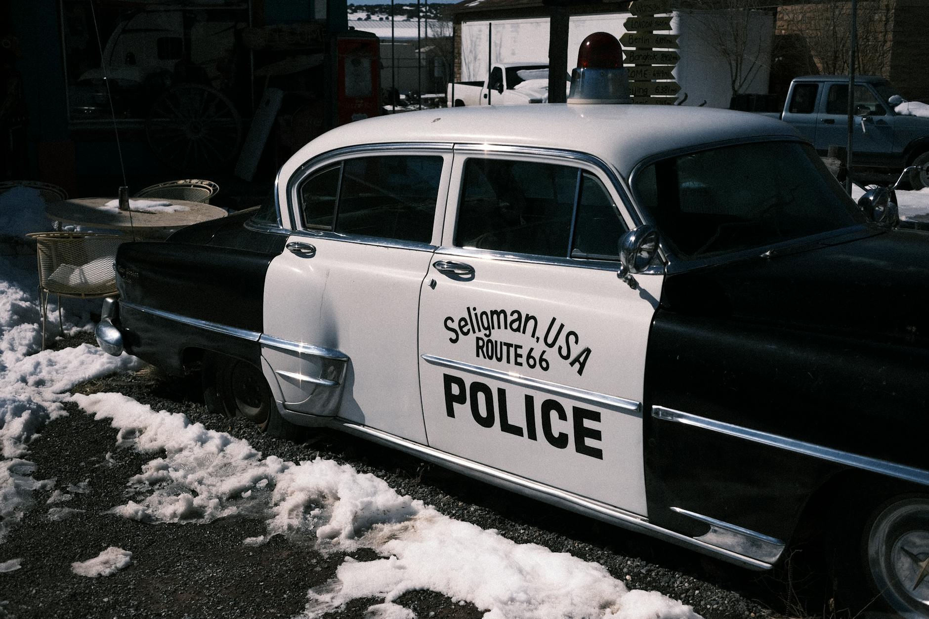
The United States didn't have a unified highway system until President Eisenhower signed the Federal Aid Highway Act in 1956. Before that, roads were a patchwork of state routes, county roads, and stretches of barely-maintained gravel. Route 66 was famous precisely because it was one of the few reliable ways to get from Chicago to the California coast — and even it had unpaved sections well into the 1930s.
Drivers in the pre-Interstate era relied on paper maps that were often outdated by the time they were printed. AAA would mail you a hand-marked "TripTik" — a spiral-bound booklet of route segments — if you were a member. If you weren't, you asked locals and hoped they knew the difference between the road that flooded in spring and the one that didn't.
Average speeds were low, not just because of speed limits but because the roads demanded it. Sharp curves, narrow bridges, and unexpected construction meant that 35 to 40 miles per hour was often the realistic cruising speed on rural stretches. A driver covering 250 miles in a day was doing well.
The Interstate Changed Everything — Almost Overnight
When the Interstate Highway System started coming online in the late 1950s and through the 1960s, the transformation was staggering. Straight, wide, engineered roads with consistent grades and proper signage let drivers cruise at 65 or 70 miles per hour for hours at a time. Distances that once required overnight stops started collapsing.
By the time the system was largely complete in the 1980s, a cross-country drive had gone from a logistical challenge to something close to a formula. You knew roughly how long each segment would take. Rest stops appeared at predictable intervals. Chain motels and fast food restaurants clustered around exits, removing the guesswork from where you'd sleep or eat.
Modern vehicles pushed things even further. A 1955 Chevrolet Bel Air got around 15 miles per gallon on a good day and needed oil checked at every fill-up. Today's highway-optimized sedans routinely hit 35 to 40 mpg, and hybrids push well beyond that. The mental overhead of managing a car on a long trip has dropped dramatically — modern engines can go 5,000 to 7,500 miles between oil changes, tires last longer, and roadside breakdowns have become genuinely rare rather than a built-in expectation.
Navigation Went From Guesswork to Superpower
Perhaps the single biggest shift in road trip culture is navigation. It's hard to overstate how different it feels to drive somewhere unfamiliar when you have real-time guidance versus when you don't.
Pre-GPS, getting lost wasn't a minor inconvenience — it was a real time cost that could eat hours out of a day. Asking for directions at a gas station was a genuine skill. People kept paper maps in the glove compartment as a matter of survival. And if you missed a turn on a rural highway, the next opportunity to correct course might be 20 miles away.
Apps like Google Maps and Waze don't just give you a route — they reroute around traffic in real time, warn you about speed traps, flag construction delays, and estimate your arrival time with unsettling accuracy. The uncertainty that defined early road travel has been almost completely engineered out of the experience.
Something Got Lost in the Efficiency
Here's the part worth sitting with: a lot of what people remember most fondly about old-school road trips is exactly the stuff that made them hard.
The roadside diner you stumbled into because you had no other option and turned out to serve the best pie you'd ever eaten. The detour through a small town that wasn't on any map. The conversation with a stranger at a gas station who told you about a shortcut that turned into a two-hour scenic adventure. None of that happens when you're locked into a blue line on a phone screen.
The Interstate made America faster and more connected. It fueled the economy, opened up tourism, and genuinely made long-distance travel accessible to millions of people who couldn't have managed it before. Those are real and important things.
But there's a reason people still talk about Route 66 with a kind of reverence that nobody's ever going to feel about I-40. One was an adventure with a destination. The other is a delivery mechanism.
The Road Trip Isn't Dead — It Just Drifted
Interestingly, road trips are more popular than ever. Post-pandemic data showed a massive surge in Americans choosing to drive rather than fly, and the RV and van-life movements have introduced a whole new generation to the idea of slow travel.
The difference is that today's road trippers choose the scenic route deliberately. They opt out of the Interstate and into the back roads on purpose. The adventure has to be intentional now, because the default setting is efficiency.
Maybe that's fine. Maybe the fact that you can choose your level of unpredictability is actually better than having it forced on you by bad roads and no cell signal.
Or maybe something real disappeared when the journey stopped being something you had to earn.